
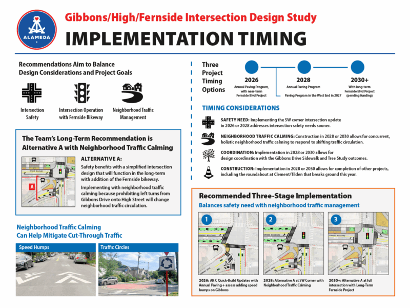
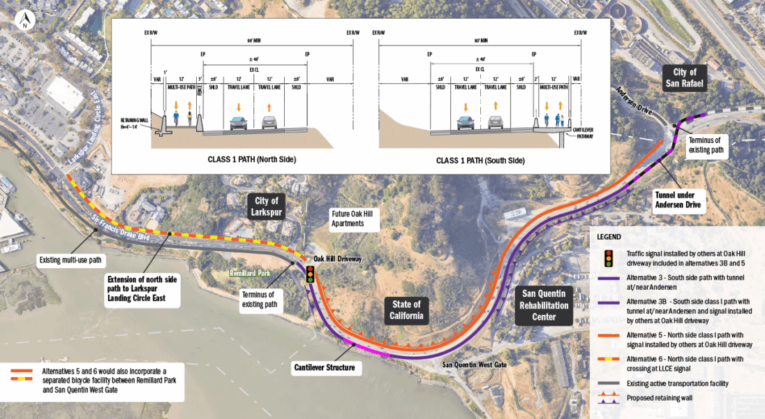
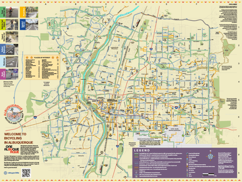
MAPS & DIAGRAMS
Examples of enhanced GIS maps, maps incorporating aerials, and diagrams.
Click on an image to see full size


Click on an image to see full size